Start Your Project Here
Need a quote? Whether you're looking for surveys, drone mapping, or access to our Datalink platform, we provide customized estimates based on your project’s unique scope and needs. Fill out the form to get started. We’ll review your details and get back to you promptly with a tailored quote.

SURVEY SERVICES
Accurate and reliable land surveying for residential, commercial, and infrastructure projects. From boundary surveys to topographic mapping, we deliver precise data to support confident decisions.

DRONE SERVICES
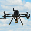
Capture high-resolution aerial imagery and site data with our drone services. Ideal for mapping, inspections, and monitoring, we help you see more and plan smarter from above.

DATALINK
Our Datalink platform gives you secure, real-time access to project data, maps, and deliverables, streamlining collaboration between teams, clients, and field crews.
Start Your Project Here
Complete the form to specify your needs: surveying, drone services, or Datalink access. We’ll assist you in taking the next step.